See your city clearly.
Act Smart.
Lisavue gives you real-time aerial intelligence on waste, road, and
traffic conditions — empowering cities to stay clean,
safe, and efficient
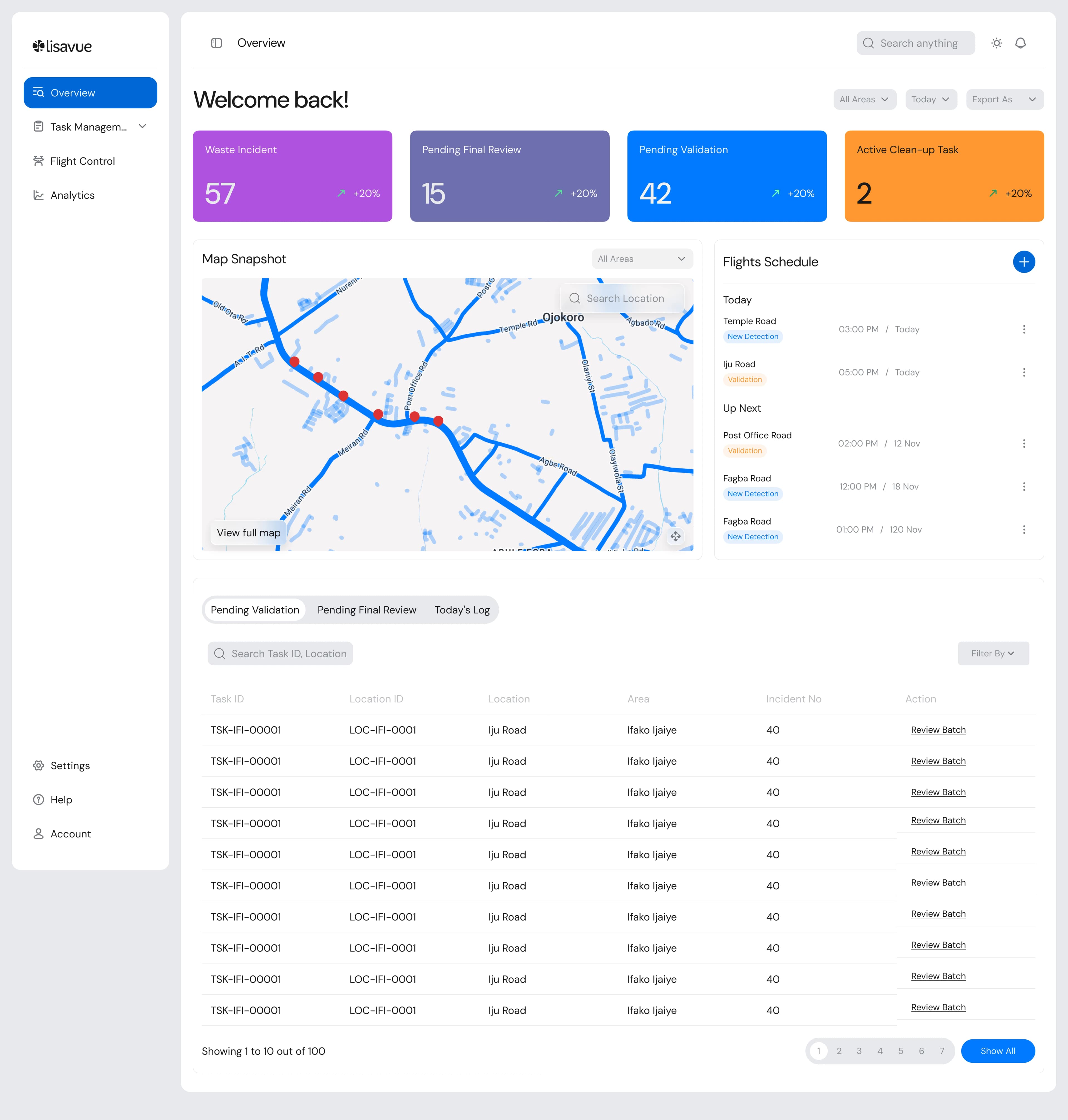
Track and monitor traffic congestion, road conditions and waste in your jurisdiction all in one place
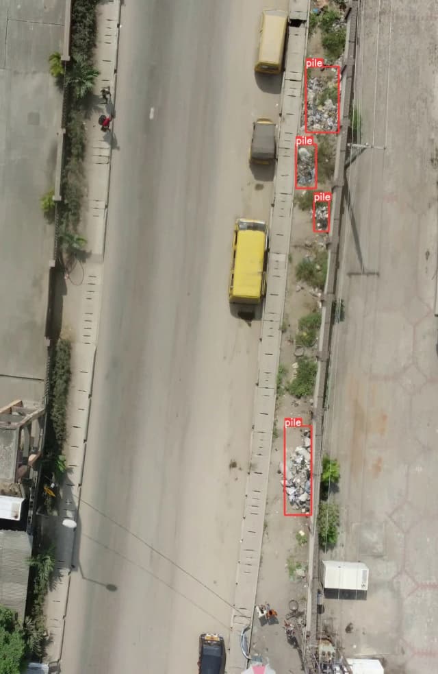
Automated Waste Detection
Identify illegal dumping and overflowing waste bins through AI-powered drone imagery.
Our system is designed to close the loop on urban issues, ensuring no incident is missed and every cleanup is verified. This is the five-step workflow that powers the next generation of city management.
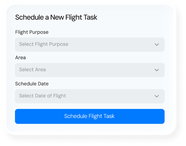
Schedule Flight
The Supervisor schedules a Flight Task (either a wide-area scan for Detection or a pinpoint flight for Validation) via the Lisavue Console
Schedule FlightScan for Incident
The AI models automatically scan the uploaded imagery for specific incident
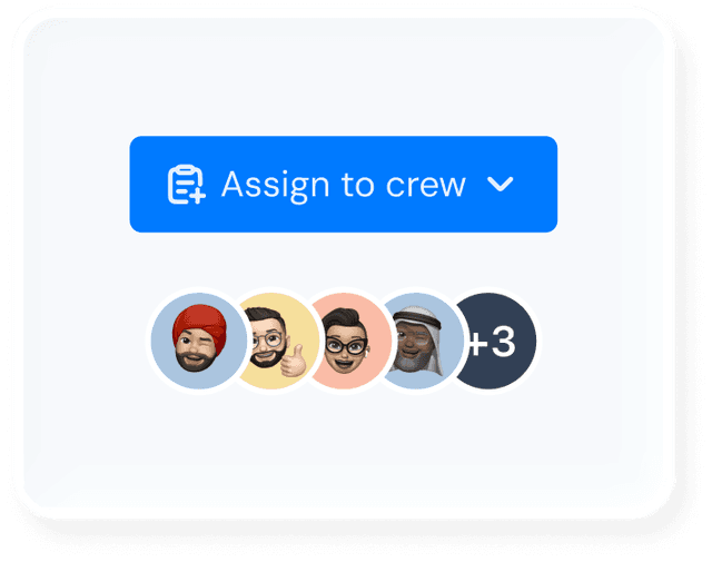
Assign Task
Approved incidents are routed to your field teams. Supervisors monitor the entire process.
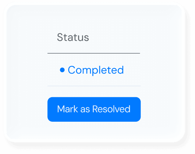
Resolve
the incident is officially marked Resolved, providing a clear, auditable trail of completion.